Students will be introduced to the main ideas of Unit 2: Age of Contact. They will be able to understand, identify, and explain key concepts that will be presented throughout the unit, including the reasons for and results of Spanish exploration of the Americas. They will be able to provide evidence from the reading passage to support statements about the unit.
THIS UNIT
Browse the contents of this unit using the tabs to the right or with the filters below.
searches descriptions only, not within downloadable content.
Share
Tell other teachers, parents, and students about us.
Follow
TX4T is replacing Resources 4 Educators. You can access Resources 4 Educators here while we make the transition.
Pacing
This unit is an eleven-day study of the Era of Spanish Exploration and the Age of Contact between the Spanish and the American Indians, specifically in Texas. There are an optional three days of extension activities which include primary source documents for analysis.
There are three additional review lessons to prepare students for testing.
Suggested pacing minutes are based on the average time it will take a class to complete each lesson; however, as the educator, use your best judgement based on the average pace of your class learning needs and styles.
Contents
Era Overview
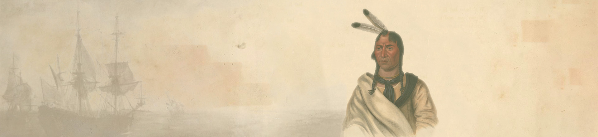
The Age of Contact (1528-1690) was the era when Spaniards – and later the French – arrived in Texas searching for wealth and hoping to find native empires (like the Aztecs or the Incans) to conquer. What followed was a series of European explorations of Texas that failed to find gold or silver, but nonetheless wrought lasting effects on American Indians in Texas. European diseases brought by these explorers, such as smallpox, ravaged indigenous populations in Texas. Spanish explorers also introduced horses (which were not native to North America) to Texas and thereby began a process of transforming groups like the Apache, which soon adapted themselves into a powerful horse culture that could more effectively raid their neighbors and defend against enemies.
By the 1540s, Spain had determined that Texas contained no gold or silver, and therefore its only real value to the Spanish was in serving as a buffer that could prevent other European powers from coming too close to the silver mines in central Mexico that brought great wealth into the Spanish Empire. When the French explorer Robert La Salle landed on the coast of Texas in February 1685, Spain launched a series of expeditions into Texas with the sole intent of finding and stamping out La Salle’s forces. Although La Salle’s settlement failed by the late 1680s, Spain decided to set up permanent settlements in Texas to prevent France – or any other European power – from establishing a foothold in Texas. To that end, Spaniards set up their first missions in 1690 near the Caddo Indians in east Texas, although these missions soon failed and were abandoned by the Spanish in 1693.
Unit Level Downloads (English)
-
Unit Plan Unit Plan MS Word Unit Plan Adobe PDF
Downloadable/Editable versions of the English language unit plan. Provides an Era Overview and pacing, and outlines each lesson’s estimated completion time, essential questions, a description of each lesson, and student learning experiences and activities.
Other Units
Lessons
Most lessons contain downloadable and printable documents, activities, and other resources to aid in classroom instruction. Lesson materials are available in multiple formats and typically contain variations based on learning needs.

The Big Picture
Unit Plan # 1
45-60 min
untlbs people ethnic groups american indians
untlbs people ethnic groups spaniards
71A
720A
720B
720D
720E
722B

How do we know what we know?
Students will review the strengths and weaknesses of available primary sources used to study early people of Texas. Students will examine a series of excerpts from a primary source account given by Cabeza de Vaca of various encounters he had with American Indians. Students will be able to summarize the accounts and identify and explain the significance of these accounts, including recognizing any bias that could be evident within them.
Unit Plan # 2
45-60 min
untlbs people ethnic groups american indians
untlbs people ethnic groups spaniards
71A
72B
720A
720B
720D
720E
720F

Vocabulary
Students will be able to identify, define, and provide an example for key terms related to the unit. Students will read passages to summarize the significance of each term and use the context to determine its meaning. Students will recognize major themes within the unit. There is an additional, optional vocabulary quiz that can be used to assess student mastery of the material.
Unit Plan # 3
90-120 min
untlbs people ethnic groups american indians
untlbs people ethnic groups spaniards
71A
72B
720B
722A
722B
722C

What's the Story?
Students will be introduced to a chronological overview of the major events, people, themes, and concepts that are central to this unit. Students will be able to identify and explain cause and effect connections between events including the Reconquista, Columbus’ arrival in America, Spanish acquisition of gold and resources, and Spain’s lack of success locating these items in Texas.
Unit Plan # 4
135 min
untlbs people ethnic groups american indians
71A
71B
72B
720B
720E
722B
722C

God, Gold, and Glory - Guided Notes Day 1
Students will examine the events that led to the Age of Contact including the Reconquista and the voyages of Christopher Columbus. Students will identify the reasons for Spanish exploration of the Americas, and several outcomes of this exploration.
Unit Plan # 5
45-60 min
untlbs people ethnic groups spaniards
71A
720B
720C
720E
722C

God, Gold, and Glory - Voices of TX history Extension Lesson
Students will use two primary source excerpts to analyze and compare different points of view related to Spanish interactions with American Indians in the Caribbean. Students will use context to determine the author’s meaning and assess the sources for bias.
Extension
45-60 min
untlbs people ethnic groups spaniards
720A
720B
720D
720E
720F
722C

The Search for Gold - Guided Notes Day 2
Students will examine four of the first significant Spanish explorers to North America, including Pineda, Cortes, Cabeza de Vaca, and Coronado. Students will be able to identify the regions they explored and the Indigenous people they encountered. They will be able to explain the significance of each explorer and demonstrate cause and effect relationships between them.
Unit Plan # 6
45-60 min
untlbs people ethnic groups spaniards
71B
72B
720A
720B
720D
720E
720F
722C

The Search for Gold – Voices of Texas History Extension Lesson
Students will use various primary source excerpts from the writings of Cabeza de Vaca and Francisco Vazquez de Coronado to analyze and compare different points of view related to Spanish interactions with American Indians in Texas and the broader American Southwest. Students will use context to determine the author’s meaning and assess the sources for bias.
Extension
45-60 min
untlbs people ethnic groups spaniards
72B
720A
720B
720D
720E
720F
722C

The Last Conquistadors & the French Arrive: Guided Notes Day 3
Students will be able to identify and explain the significance of the final Spanish conquistadors to pass near or through Texas, including Hernando de Soto, Luis de Moscoso Alvarado, and Juan de Oñate. Students will be able to make a claim about the success or failure of each expedition based on evidence from short reading passages. Students will be able to identify and explain the significance of the arrival of the French explorer La Salle, and how his arrival affected Spain’s view of Texas.
Unit Plan # 7
45-60 min
untlbs people ethnic groups spaniards
untlbs people ethnic groups french
72B
720A
720B
720D
720E
720F
722C

The Last Conquistadors & the French Arrive – Voices of Texas History Extension Lesson Day 3
Students will be able to identify and explain the significance of the final Spanish conquistadors to pass near or through Texas, including Hernando de Soto, Luis de Moscoso Alvarado, and Juan de Oñate. Students will be able to make a claim about the success or failure of each expedition based on evidence from short reading passages. Students will be able to identify and explain the significance of the arrival of the French explorer La Salle, and how his arrival affected Spain’s view of Texas.
Extension
45-60 min
untlbs people ethnic groups spaniards
untlbs people ethnic groups french
72B
720A
720B
720D
720E
720F
722C

Texas Today
Students will be able to identify specific examples of Spanish and American Indian influence on the geography of Texas today. These examples include the names of human and geographic features of Texas. Students will be able to identify the diverse cultural origins of the location names.
Unit Plan # 8
45-60 min
untlbs people ethnic groups spaniards
72B
718C
720B
720C
721A

Looking Ahead
Students will connect prior knowledge about Spain’s goals for exploration with information they will see in the next unit. Students will review Spain’s failure to find gold in Texas, and use readings, context, and prior knowledge to predict what Spain might focus on next in Texas. Students will read primary source excerpts about the struggles of an east Texas mission in order to identify Spain’s next goal in Texas, the reasons for this goal, and the challenges of carrying out the goal.
Unit Plan # 9
45-60 min
untlbs people ethnic groups spaniards
71A
72B
72C
720A
720B
720C
720D
720E

Study Guide
Students will review significant terms, concepts, and information from the unit to prepare for the test. Students will identify the significance of key terms, events, and people, make claims about information within the unit and support their claims with evidence, and practice answering questions that are based on the 8th grade STAAR question types.
Unit Plan # 10
45-50 min
untlbs people ethnic groups spaniards
71A
71B
72B
720B

Mind Mapping Review Lesson
Students will create a visual representation of the connections between terms and concepts from the unit in a mind map. Students will be able to visualize how information from the unit is connected by making connections between terms on a mind map.
Unit Plan # 11
45-60 min
untlbs people ethnic groups american indians
untlbs people ethnic groups spaniards
untlbs people ethnic groups french
71A
71B
72B
720B
720C
720E
722C

Bingo Review Game
In this optional review lesson, students will play Bingo to review key terms and concepts within the unit by listening to clues to identify terms and concepts. Students will write brief summaries or key words related to each term.
Unit Plan # 12
45-60 min
untlbs people ethnic groups american indians
untlbs people ethnic groups spaniards
untlbs people ethnic groups french
71A
71B
72B
720B
720E
722A
722B
Maps
We've assembled the following list of maps that are applicable to the Age of Contact Unit.

Tabula nouarum insularum, quas diuersis respectibus Occidentales & Indianas uocant
Map shows known mid-sixteenth century geography of the Western Hemisphere. Scale not given.
Map of Europe as queen
"Map shows a stylized Europe in the form of a woman. [Spain] is her head and [Gaul], [Germany], [Denmark], [Poland], [Hungary], [Greece], [Bulgaria], [Macedonia], and Scythia are the remainder of her body."
Nueva Hispania tabula nova
Map shows known geography, rivers, and settlements in early sixteenth century New Spain [Mexico].
Hispaniae novae sivae magnae, recens et vera descripto 1579
Map shows Pacific Coast of the central portion of New Spain with large lake and four named islands (with numbered key) in upper left corner and "Notularum circa Mexico explanatio" in the lower right corner; title cartouche in upper right corner, secondary cartouche in lower left corner.
Maris Pacifici (quod vulg ̣Mar del Zur) : cum regionibus circumiacentibus, insulisque in eodem passim sparsis, novissima descriptio
Map shows known and assumed geography and place names of land masses and islands in the late sixteenth century Pacific Ocean.
America
Map shows early seventeenth century known and assumed geography, settlements, territorial claims, and areas of Native American habitation in North America, South America, and West Indies.
America noviter delineata
Map of North and South America showing political boundaries and place names. Includes inset of Greenland and illustrations of ships and sea monsters.
Audience de Mexico
Map of Mexico and surrounding areas. Relief shown pictorially. Prime meridian: Ferro.
Nova Mexico
Map shows a late seventeenth century "Nova Mexico" settlement. Streets and buildings are visible in the settlement and there are Native Americans, Spanish landlords, and domestic animals depicted in the foreground.
Nova Hispania, Nova Galicia, Guatimala
Map shows geography and settlements in late seventeenth century Central America and Mexico.
Le nouveau Mexique, appelé aussi Nouvelle Grenade et Marata, avec partie de Californie : selon les memoires les plus nouveaux
Map shows settlements, areas of Native American habitation, and coastal points along "Isle de Californie" and "Mer de Califronie" and inland to the Rio del Norte beyond Santa Fe.
Hos Globos Terracqueum, ac Cœlestem dicat, et donat Rm̃o P.D. Sigismundo Pollitio à Placentia Prœposito Generali Monachorum Eremitorum S. Hyeronimi Congreg: Lombardiæ, P.M. Coronelli, Cosmographus P.
Map shows world continents and oceans, with vague boundaries for parts of Australian coast, Antarctica, and Pacific coast of North America.
Mexique ou Nouvelle Espagne
Map shows geography, political boundaries, and major cities of late seventeenth century New Spain [Mexico].
Videos
We provide videos for both continuing education and classroom use. Please see each video's descriptive page for related resources and details about accessibility and viewing options.

Preview of Age of Contact
The video describes the arrival of the first Europeans in Texas, led by Cabeza de Vaca, who washed ashore in 1528 after a failed expedition. Although the Spanish initially left Texas, their brief presence had profound effects, including the introduction of European diseases that devastated Native populations and the accidental release of horses, which transformed the hunting and military capabilities of tribes like the Apache and Comanche. When Spain returned to Texas in the 1680s, they encountered a dramatically changed landscape with fewer but more powerful Native groups.
Spanish Explorations
Spanish exploration, covering: (1) The Aztecs and Cortes, (2) The Debacle of Cabeza de Vaca, (3) Coronado’s Expedition, (4) De Soto’s Expedition, (5) Transforming and Abandoning Texas.
More Resources
The following list of resources provide additional information to help you dive deeper into the context of the unit. Books are linked to OCLC WorldCat, allowing you find a copy in your nearest local library or to make a request for it using interlibrary loan.
General
website Results for The Age of Contact in The Portal to Texas History
Digital copies of primary sources and other documents from our about this time period contributed to The Portal to Texas History by institutional partners from across the State.
website The Handbook of Texas
A digital encyclopedia developed by the Texas State Historical Association (TSHA) that is free and offers in-depth, reliable, and authoritative entries on every aspect of Texas history.
American Indian Perspectives
book David La Vere, The Texas Indians (Texas A&M University Press, 2004).
book Gary Clayton Anderson, The Indian Southwest, 1580-1830 (University of Oklahoma Press, 1999).
Spanish Perspectives
book Andres Resendez, A Land So Strange: The Epic Journey of Cabeza de Vaca (Basic Books, 2007).
book David Weber, The Spanish Frontier in North America (Yale University Press, 1992).
French Perspectives
book Robert Weddle, The Wreck of the Belle: The Ruin of La Salle (Texas A&M University Press, 2001).