THIS UNIT
Browse unit contents using the tabs to the right or the filters below.
Share
Tell other teachers, parents, and students about us.
Follow
Pacing
Contents
Era Overview
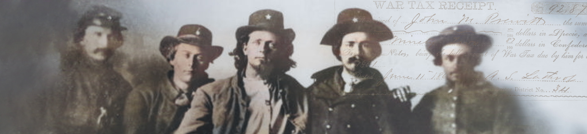
When the Civil War broke out in 1861, tens of thousands of Anglo-Texans enlisted in the new Confederate armies. A small number of Texans – most notably those who served in Hood’s Brigade – fought in battles on the eastern front, in places like Virginia and Pennsylvania. But the vast majority of Texas soldiers served on the western front, with Confederate armies along the Mississippi River. Other Texans served the state’s home guard along the edges of Anglo-Texan settlements and Indian nations. Some Texans, however, particularly within German communities, resisted the Confederacy.
Texas itself was not the scene of major battles, which allowed the state to support the Confederate war effort in three key areas. First, Texas supplied food and clothing to Confederate armies, since Texas farms had not been devastated by battles or invading Union troops. Second, Texas used its border with Mexico to break through the Union blockade that the U.S. used to prevent the Confederacy from shipping its cotton abroad. Third, Texas became a place of refuge for Confederates seeking to hide from U.S. armies. This became particularly important to Confederate slaveholders who hoped to prevent their enslaved people from running to freedom behind Union lines. As a result, Confederates brought an estimated 50,000 enslaved people to Texas during the war, swelling the enslaved population of the state to 230,000 by 1865.
When the Confederacy lost the war in 1865, legalized slavery came to an end in Texas. On June 19, 1865 – celebrated today as “Juneteenth,” a national holiday – the U.S. Army arrived in Galveston, Texas, and announced the end of slavery in Texas. Juneteenth marked a massive shift within the state, freed nearly a quarter of a million people, and began a process of remaking the state’s economic, political and social structures.
Other Units
Maps
We've assembled the following list of maps that are applicable to the Civil War Unit.
![[Civil] War maps and diagrams](data:image/gif;base64,R0lGODlhAQABAAAAACH5BAEKAAEALAAAAAABAAEAAAICTAEAOw==)
[Civil] War maps and diagrams
"Map shows forts, towns, railroads, and rivers in the vicinity of Annapolis, Key West, the Mississippi River, Chesapeake Bay and vicinity, Charleston, New Orleans, Savannah, Mobile Bay, the United States, Cairo, Pensacola Bay, Galveston Bay, Norfolk, Hampton Roads, Washington, D.C., and Harpers Ferry."
Map showing the comparative area of the Northern and Southern states east of the Rocky Mountains, 1861
"Map shows states, territories, major cities, and regional boundaries in the eastern half of the mid-nineteenth century United States."
H.H. Lloyd & Co's. campaign military charts showing the principal strategic places of interest
"Map shows major cities, military outposts, boundary lines for Old California, New Mexico, Texas, and Mexico. Includes dates in notes on boundary lines."
Map showing the distribution of slaves in the Southern States
"Map shows distribution of enslaved peoples, state and territorial boundaries, and major cities; agricultural products for the southern states on inset. Includes table of statistics and key to map."
Military map of the United States & Territories : showing the location of the military posts, arsenals, navy yards, & ports of entry
"Map shows the location of military posts, arsenals, naval yards, and ports. Insets: "Key West," "Pensacola" and "Perdido" bays. Includes supplement showing locations of military operations."
Colton's United States : showing the military stations, forts & c.
"Map shows mid-nineteenth century United States geography, states, cities, and military installations. Relief shown by hachures."
Lloyd's Military Maps, Showing the Principal Places of Interest, compiled from official data by Egbert L. Viele and Charles Haskins, Military and Civil Engineers. Published under the auspices of the American Geographical and Statistical Society
"Lloyd's Military Maps, Showing the Principal Places of Interest, compiled from official data by Egbert L. Viele and Charles Haskins, Military and Civil Engineers."
Map of the United States, showing the territory in possession of the Federal Union, January 1864
"Map shows mid-nineteenth century United States geography, states, cities, and military installations. Relief shown by hachures."
How the war commenced and how near it is ended
"Map shows, by color, the territories "claimed by the confederates in 1861," "in the military possession of the Confederates in 1861," "reclaimed from rebellion by the Federal Union," and 'remaining in possession of the Rebels January, 1864.'"
Videos
We provide videos for both continuing education and classroom use. Please see each video's descriptive page for related resources and details about accessibility and viewing options.

Preview of the Civil War
This video explores Texas’ pivotal role in the Civil War, challenging common misconceptions about its significance. Learn how Texas supported the Confederacy in several key ways during the Civil War.
Secession
The secession of Texas from the United States, covering: (1) John Brown’s Raid, (2) The Election of 1860, (3) Texas and Secession.
Civil War
The U.S. Civil War, covering: (1) War Breaks Out, (2), Texans in the Confederate Armies,(3) Life on the Homefront, (4) End of War, End of Slavery.
More Resources
The following list of resources provide additional information to help you dive deeper into the context of the unit. Books are linked to OCLC WorldCat, allowing you find a copy in your nearest local library or to make a request for it using interlibrary loan.
General
website Results for The Civil War in The Portal to Texas History