A one-day lesson presenting the major themes of the unit with an image, a reading, and questions.
THIS UNIT
Browse unit contents using the tabs to the right or the filters below.
Share
Tell other teachers, parents, and students about us.
Follow
Pacing
Total length of all materials in the unit: 15 days
- 12 Estimated Instructional Days
- 3 optional review days prior to assessment
Just the Basics: To meet the TEKS requirements while minimizing the amount of time spent in the unit, educators can focus solely on the following lessons (Approximately 9 - 11 class periods)
- The Big Picture (1 class period)
- Vocabulary (2 class periods)
- What’s the Story? (1 - 2 class periods)
- The Mission Presidio System (1 class period)
- Texas Missions (3 - 4 class periods)
- Mexican Independence and the Filibusters (1 class period)
Contents
Era Overview
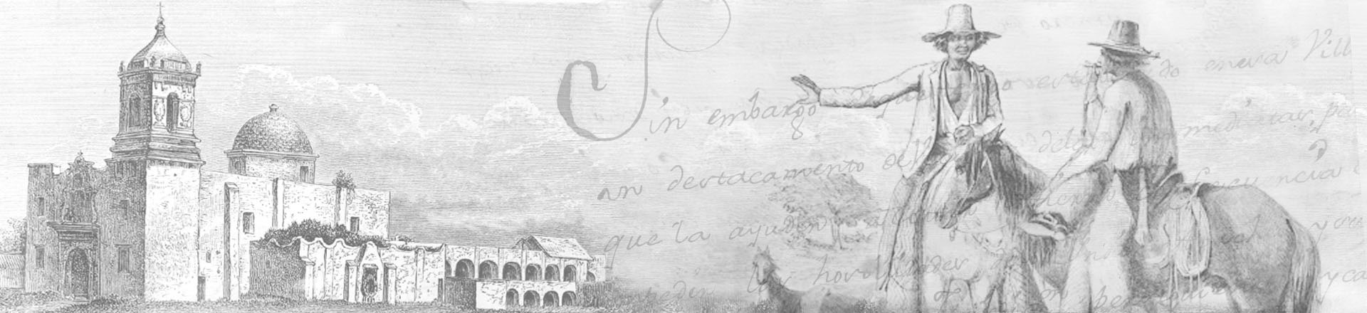
During the Spanish Colonial Era (1690-1820), Spain made numerous attempts to settle and control Texas. But the major challenge that Spain never overcame was that various American Indian tribes remained the dominant forces controlling the regions that would eventually become Texas.
Beginning in the 1690s, Spaniards attempted to control Texas by establishing numerous missions throughout the region. The goal of these missions was to instruct local native peoples on Spanish civilization and, in the process, transform them into loyal Spanish subjects. Yet these missions never succeeded because they failed to attract Indians (since virtually none wanted to adapt themselves to Spanish culture) and Spanish authorities in Mexico City put few resources into supporting these far-flung missions. Spain, as a result, never secured a strong presence in Texas and began abandoning the region’s mission system during the 1790s.
By the early 1800s, the Comanches and Apaches of the Texas Plains and the Caddos of East Texas controlled far more of the region than did the Spanish.
When the Mexican War for Independence broke out in 1810, the violence and bloodshed that followed further weakened the already anemic Spanish presence within Texas. When Comanches and Apaches responded by increasing their raiding of San Antonio during the 1810s, Spain’s presence in Texas careened toward the edge of total collapse. By late 1820, the situation had become so dire that the Spanish leadership in San Antonio considered abandoning the province altogether. Which turned out to be the same moment that Moses Austin arrived in San Antonio from the United States with a proposal to bring American colonists into Texas.
Unit Level Downloads (English)
-
Downloadable/Editable versions of the English language unit plan. Provides an Era Overview and pacing, and outlines each lesson’s estimated completion time, essential questions, a description of each lesson, and student learning experiences and activities.
Other Units
Lessons
Most lessons contain downloadable and printable documents, activities, and other resources to aid in classroom instruction. Lesson materials are available in multiple formats and typically contain variations based on learning needs. Learn more about alternative formats here.

The Big Picture
Unit Plan # 1
45-90 min
untlbs people ethnic groups american indians
710A
720B
720C
720E
722A
722B

How do we know what we know?
In this one-day lesson, students examine primary source materials related to the Spanish Colonial Era.
Unit Plan # 2
45-60 min
untlbs people ethnic groups american indians
keywrd people soldiers
keywrd people missionaries
710A
720A
720B
720C
720D
720E
720F
722A
722B

Vocabulary
This two-day lesson presents unit vocabulary in short readings that provide the terms in the context of significant information from the unit. Students use the readings to complete vocabulary charts and take a vocabulary quiz.
Unit Plan # 3
90-120 min
none
71A
71B
720B
722A
722B
722C

What's the Story?
This lesson presents a chronological overview of the major events and themes of Unit 3: The Spanish Colonial Era. Students complete a timeline of the significance of each event and answer comprehension questions about the major themes.
Unit Plan # 4
45-60 min
none
710A
720B
720C
722A

The Mission Presidio System - Guided Notes
This one-day lesson explains what the Mission Presidio System was and why Spain established the system in Texas. It summarizes the significance of the first missions in east Texas and the founding of San Antonio.
Unit Plan # 5
45-60 min
none
72C
720B

Texas Missions
In this three-day lesson, students research and create a presentation for one of seven key Texas missions based on reading passages.
Unit Plan # 6
135-180 min
none
71B
72C
718C
720B
720E
722A
722B
722C

Mexican Independence and the Filibusters
A one-day lesson outlining the causes of the war for Mexican Independence, the key events and people including the filibusters in Texas, and the war’s outcome.
Unit Plan # 7
45-60 min
none
71B
72D
720B
720D

Texas Today
This one-day lesson examines eight contemporary elements of Texas culture that originated during the Spanish Colonial Era.
Unit Plan # 8
45 min
untlbs people ethnic groups american indians
keywrd people ethnic groups hispanics tejanos
718C
720B
722B
722C

Looking Ahead
In this one-day lesson, students examine primary source excerpts from a newspaper, letters, and a government report to analyze the challenges facing Mexico in 1821, including specifically its weak position in Texas.
Unit Plan # 9
45-60 min
keywrd people ethnic groups hispanics tejanos
71A
720A
720B
720D
720E
723B

Study Guide and Flashcards
A one-day lesson to review key components of the Spanish Colonial Era unit including major themes and significant people, places, and events.
Review
45-60 min
none
71A
71B
72C
720A
720B

Review Mind Map
In this one-day lesson students will make connections between key topics covered in the unit by creating a mind map using sets of terms.
Review
45-60 min
71A
71B
72C
72D
720B
720C
720E
722C

Review Bingo Game
This one-day review lesson provides students with an opportunity to review key terms in a fun and engaging game of Bingo.
Review
45-60 min
71A
71B
72D
720B
720C
720E
722C
Maps
We've assembled the following list of maps that are applicable to the Spanish Colonial Unit.

L'Amerique meridionale et septentrionale : dressée selon les dernieres relations et suivant les nouvelles decouvertes dont les points principaux sont placez sur les observations de Mss. de l'Academie Royale des Sciences
Map shows late seventeenth century geography, cities, political borders, and points of interest in North America, South America, and parts of England and France.
Idea naturalis Americae Borealis digito dei formata geographice proposita an MDCC
"Map shows southern and eastern portions of North America, Central America, the northeast coast of South America, the Caribbean islands, and California (depicted as an island)."
Le vieux Mexique, ou, Nouvelle Espagne avec les costes de la Floride : faisant-partic de l'Amerique septentrionale / par N. de Fer.
"Relief shown pictorially. Hand colored. Paris : Chez l'auteur dans l'Isle du Palais sur le quay de l'Orloge a la sphere royale avec privil du roy, 1702."
Théâtre de la guerre en Amerique telle qu'elle est à present possedée par les Espagnols
"Map shows the route of the Spanish fleet between Veracruz and Havana; possessions of Spain, England, France and Holland; boundaries, cities, settlements, islands and coastlines for the Gulf of Mexico."
North America: corrected from the observations communicated to the Royal Society at London, and the Royal Academy at Paris
"Map shows major settlements, areas of Native American habitation, and political divisions for the known extent of the continent of North America as far as the headwaters of the Mississippi River and the Great Lakes; Florida, Mexico, New Spain, islands of the West Indies, New Mexico, Greenland, New France, and New Britain; northwestern portions as 'incognita,' with a series of lakes and a 'lake of salt,' and lands of the nations of 'Mozeemlecks' and 'Gnacsitares.'"
Carte tres curieuse de la mer du sud, contenant des remarques nouvelles et tres utiles non seulement sur les ports et iles de cette mer: mais aussy sur les principaux pays de l'Amerique tant Septentrionale que Meridionale, avec les noms & la route des voyageurs par qui la decouverte en a ètè faite [Sheet 1]
"Map shows major settlements and coastal details for North and South America, western portions of Europe and Africa and eastern portions of Asia."
A map of Mexico or New Spain, Florida now called Louisiana and part of California &c.
"Map shows settlements, areas of Native American habitation, and notable physical features from the lower portion of North America to the northwestern corner of South America."
Carte du Mexique et de la Floride des terres anglaises et des Isles Antilles, du cours et des environs de la riviere de Mississippi
"Map shows cities, towns, and geographical features of Mexico, the West Indies, and Florida as known during the early eighteenth century."
Mexique ou Nouvelle Espagne suivant les nouvelles observations de messrs. de l'Academie Royale des Sciences, etc.
"Map shows the provinces of New Spain and major towns, the Yucatan peninsula, and upper Central America."
Mappa geographica complectens, I. Indiae occidentalem, II. Isthmum Panamensem, III. Ichnographiam præcipuorum locorum & portuum ad has terras pertinentium : Desumta omnia ex Historia Insulæ S. Dominici & pro præsenti statu belli, quod est 1740 inter Anglos & Hispanos exortum
"Map shows European possessions, cities, settlements, and notable physical features; fortification, streets, buildings, and harbor layout for cities in mid-eighteenth century Mexico, Central America, and the West Indies."
North America : performed under the patronage of Louis Duke of Orleans, First Prince of the Blood [Sheet 4]
"Map shows provinces, cities, towns, forts, Native American villages, tribal territory, shoals, banks, and other details along the coast of Mexico."
Mexico, or, New Spain in which the motions of Cortes may be traced
"Map shows provinces of New Spain, [Baja] California, "New Albion." Includes notes. New Mexico and Louisiana are shown separated by "Great Space of Land unknown." Areas of Native American habitation are noted."
Charte von Nordamerica : nach den neuesten Bestimmungen und Entdeckungen
"Map shows French Louisiana, the United States toe the Mississippi River, West Indies, British possessions, and Spanish possessions of New Mexico and New Spain; particular detail along the northwest Pacific coast of North America, large portion of western [future United States] is left blank and labeled as "Quivira"; major cities, major roads, and areas of Native American habitation."
The First Map of Texas: A Sketch of Alfonso Álvarez de Pineda's exploration of the Gulf of Mexico, taken from the original in the Archivo de Indias
"Map drawn by Pineda while on a royal mission in 1519 to map the unknown shoreline between Florida and Cabo Rojo. Pineda’s map is the first known topographic rendering of the Texas coastline."
A map of early expeditions through the Gonzales County region, 1689-1768
"Map shows scenes of exploration and Native Americans in early Gonzales County, Texas."
Videos
We provide videos for both continuing education and classroom use. Please see each video's descriptive page for related resources and details about accessibility and viewing options.

Preview of the Spanish Colonial Period
A short introductory video to the Spanish Colonial Unit. Includes worksheets and/or other attachments.
Spaniards in Indian Country
Spanish exploration in Texas, covering: The World that Silver Made, Presidios and Missions, La Salle and the French Threat.
The (Many) Failures of the Spaniards
Spanish colonization in Texas, covering: First & Second Attempt of 1690-1722, Life on the Spanish Frontier, Arrival of the Comanche, Texas by 1800.
Collapse of Spain in Texas (Part 1)
The end of Spanish colonization and rule in Texas, covering: Texas by 1800; Major Problems for Spain in Texas.
Collapse of Spain in Texas (Part 2)
The end of Spanish colonization and rule in Texas. Covering: Major Problems for Spain in Texas Mexico’s Dilemma of Independence.
Tours
This section contains various kinds of multimedia resources that are meant to engage the student through virtual exploration and active engagement. Items may contain Video Tours, Virtual Field Trips, Timelines, Maps, and other media. Please Note: some features are experimental, work best on a large, or full screen. Most items contain visually rich media with movement, and some items require physical manipulation of items on the screen with a mouse or touch device.

Presidio San Saba: Virtual Field Trip
Explore Presidio San Saba virtually by walking through the site, viewing archival and aerial photos.
More Resources
The following list of resources provide additional information to help you dive deeper into the context of the unit. Books are linked to OCLC WorldCat, allowing you find a copy in your nearest local library or to make a request for it using interlibrary loan.
General
website Results for Spanish Texas, 1690-1821 in The Portal to Texas History
Digital copies of primary sources and other documents from our about this time period contributed to The Portal to Texas History by institutional partners from across the State.